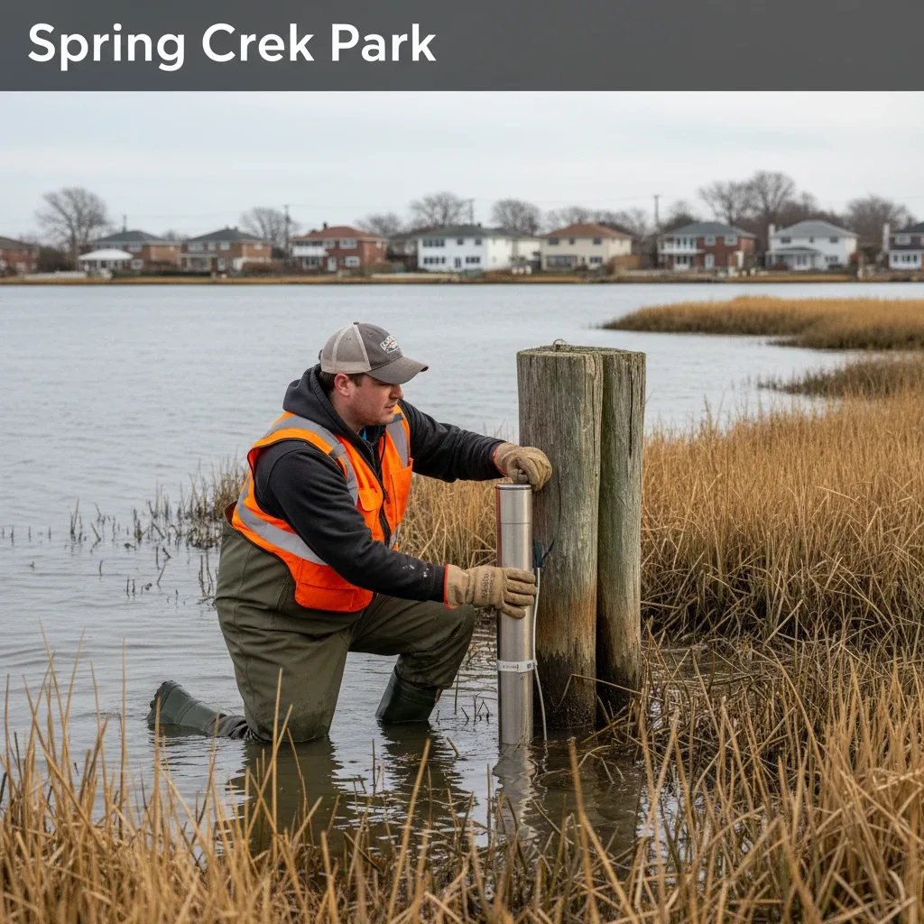
Howard Beach Weather System Expanded for Tidal Surge Alerts By Newstrix | February 22, 2026 | Health & Weather NEW YORK — New York City Parks Commissioner Sue Donoghue finalized a coastal wetland restoration initiative Monday after a series of peak tidal surveys, Department of Parks and Recreation documents confirmed. The project aims to combat ongoing shore erosion near Shellbank Basin. The environmental project will utilize natural marsh barriers and engineered sand placement to buffer lowlying streets from recurring high tides. The Parks Department is coordinating with the Department of Environmental Protection to monitor soil saturation and water levels in real time. Parks Department Installs Coastal Marsh Monitoring Stations Crews began placing automated water sensors along the perimeter of Spring Creek Park early Monday morning, expanding the city's network of realtime environmental data collectors. These instruments will track changes in water temperature, salinity, and tidal height. When the conditions occur, municipal water systems face severe backflow pressures that flood local intersections. By analyzing data from these new monitoring stations, engineers hope to predict drainage failures hours before peak high tides occur. Commissioner Donoghue Outlines NatureBased Flood Protection Plans "We must employ both naturebased solutions and modernized engineering to protect our vulnerable coastal neighborhoods from tidal encroachment," Parks Commissioner Sue Donoghue said in an announcement released Monday afternoon. Donoghue added that the department plans to plant thousands of native saltmarsh grasses to stabilize the fragile shoreline. The project is designed to absorb wave energy and reduce the speed at which high tides advance into residential canals. Local environmental groups have expressed strong support for the initiative, noting that natural marshes provide vital ecosystems while serving as natural flood barriers. Environmental Studies Track Tidal Intrusion Across LowLying Basins Recent scientific evaluations published by the indicate that tidal intrusion into the local sewer network has increased over the past decade. This trend requires a shift toward proactive infrastructure management to prevent chronic street flooding. Engineers are utilizing historical weather data to design adaptive drainage systems that can close off outfalls during peak high tides while maintaining internal capacity. These technological upgrades are essential for protecting lowlying properties in old Howard Beach and Hamilton Beach. Hamilton Beach Shorelines Underwent Severe Coastal Erosion in Recent Storms During recent winter coastal storms, high winds and elevated waves eroded significant portions of the sandy buffers along Jamaica Bay's northern shore. This physical damage has left adjacent streets increasingly vulnerable to standard hightide phases. Municipal response teams are working to restore these protective dunes using clean sand sourced from local navigation dredging projects. This costeffective strategy addresses both waterway maintenance needs and coastal protection objectives simultaneously. Monitoring Equipment Scheduled for Full Operational Launch by April Environmental protection officials confirmed that the newly installed sensor network is scheduled to become fully operational by midspring. The data gathered will be integrated into the city’s emergency alert system, providing residents with localized flood warnings. Civic leaders have welcomed the project, highlighting the critical need for advanced warning systems in coastal neighborhoods. As weather patterns become increasingly volatile, precise local data remains the cornerstone of municipal preparedness. Frequently Asked Questions How do coastal marshes help protect Howard Beach from tidal surges? Healthy salt marshes act as physical shock absorbers, dispersing wave energy and slowing the overland movement of tidal water during storm surges. Furthermore, the root systems of native vegetation, such as Spartina alterniflora, bind coastal soils together, preventing the severe erosion that can undermine roadways and utility lines. Where can local residents access realtime coastal flood hazard maps? Residents can access detailed flood hazard mapping and realtime tidal gauge data through the New York City Emergency Management website and the Federal Emergency Management Agency's portal. These interactive maps allow property owners to analyze localized storm surge projections and identify recommended evacuation routes.